Geolocate

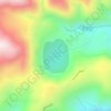
Gondohon topographic map

Click on the map to display elevation.

About this map

Name: Gondohon topographic map, elevation, terrain.

Location: Gondohon, Ranau, West Coast Division, Sabah, 89308, Malaysia (5.95269 116.50940 5.99269 116.54940)

Average elevation: 1,238 m

Minimum elevation: 916 m

Maximum elevation: 1,594 m

Other topographic maps

Click on a map to view its topography, its elevation and its terrain.
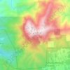
Kinabalu Park

Malaysia > Sabah > Ranau > Tinompok

The park headquarters is 88 kilometres away from the city of Kota Kinabalu. There are sealed roads leading towards the park headquarters from other parts of Sabah. It is situated on the southern boundary of Kinabalu Park, at an elevation of 1,563 m (5,128 ft).

Average elevation: 2,063 m
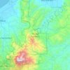
Kinabalu Park

Malaysia > Sabah > Ranau

Average elevation: 625 m

Sungai Mesilau

Malaysia > Sabah > Ranau > Kundasang

Average elevation: 1,802 m

Mamut Copper Mine

Malaysia > Sabah > Ranau

Average elevation: 1,437 m

Kinabalu Park

Malaysia > Sabah > Ranau

Average elevation: 625 m

Sungai Liwagu

Malaysia > Sabah > Ranau > Kampung Kimolohing

Average elevation: 633 m

Gear up for your next adventure:

👟Waterproof Leg Gaiters - Keep mud and water out of your boots in boggy terrain
🌦️Portable Weather Meters - Handheld tools for monitoring weather conditions
📸Action Camera Chest Mounts - Record your ascent following topographic paths hands-free
🛑Emergency Bivvy Bags - Heat-reflective survival bags for unexpected nights out
🎒Multi-day Trekking Packs - Large capacity backpacks for wild camping and long-distance trails

As an Amazon Associate, this site earns from qualifying purchases at no extra cost to you.