Geolocate

Center topographic map

Click on the map to display elevation.

About this map
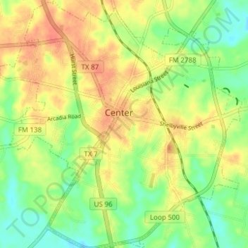
Name: Center topographic map, elevation, terrain.

Location: Center, Shelby County, Texas, 75935, United States (31.76645 -94.21010 31.81895 -94.14955)

Average elevation: 99 m

Minimum elevation: 75 m

Maximum elevation: 120 m

Other topographic maps

Click on a map to view its topography, its elevation and its terrain.
Mount Herman

United States > Texas > Shelby County

Average elevation: 124 m

Gear up for your next adventure:

🧭GPS Trackers - Tracking devices for safety and navigation
🔦Keychain LED Torches - Emergency backup light for finding gear in your pack
🗺️Scratch-off Peak Maps - Track your progress climbing Munros or Wainwrights
🗺️Ordnance Survey Maps - Essential paper maps for hiking across the UK national parks
🛌Sleeping Mats - Insulated mats for comfortable outdoor sleeping

As an Amazon Associate, this site earns from qualifying purchases at no extra cost to you.