Geolocate

Denmark River topographic map

Click on the map to display elevation.

About this map

Name: Denmark River topographic map, elevation, terrain.

Location: Denmark River, Scotsdale, Denmark, Western Australia, 6333, Australia (-34.97809 117.32304 -34.88545 117.37483)

Average elevation: 55 m

Minimum elevation: -1 m

Maximum elevation: 207 m

Other topographic maps

Click on a map to view its topography, its elevation and its terrain.
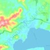
Denmark

Australia > Western Australia > Denmark

Average elevation: 43 m

Gear up for your next adventure:

🔭Compact Hiking Binoculars - Lightweight optics for scouting terrain and spotting wildlife
🌂Windproof Trekking Umbrellas - Surprising but effective rain protection on low-wind trails
🕶️Glacier Goggles - Maximum protection for high-altitude snow topography
🛰️Satellite Messengers - Emergency communication devices for areas without mobile signal
🥼Base Layers - Thermal base layers for temperature regulation

As an Amazon Associate, this site earns from qualifying purchases at no extra cost to you.