Geolocate

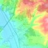
Maceira topographic map

Click on the map to display elevation.

About this map

Name: Maceira topographic map, elevation, terrain.

Location: Maceira, Leiria, Portugal (39.63687 -8.94159 39.74256 -8.85408)

Average elevation: 121 m

Minimum elevation: 38 m

Maximum elevation: 193 m

Other topographic maps

Click on a map to view its topography, its elevation and its terrain.
Santa Catarina da Serra

Portugal > Leiria > Leiria

Average elevation: 281 m

Carril

Portugal > Leiria > Leiria > Regueira de Pontes

Average elevation: 60 m

Conqueiros

Portugal > Leiria > Leiria > Souto de Carpalhosa

Average elevation: 90 m

Assenha

Portugal > Leiria > Leiria

Average elevation: 114 m

Marvila

Portugal > Leiria > Leiria

Average elevation: 107 m

Ortigosa

Portugal > Leiria > Leiria

Average elevation: 52 m

Brogal

Portugal > Leiria > Leiria

Average elevation: 82 m

Cortes

Portugal > Leiria > Leiria

Average elevation: 125 m

Cantomilo

Portugal > Leiria > Leiria

Average elevation: 120 m

Gear up for your next adventure:

🥄Titanium Camping Sporks - The ultimate lightweight utensil for trail meals
🥫Expedition Meals - Lightweight, high-calorie nutrition for long-distance hikers
🧴Tick Removal Tools - Small, essential health tool for UK woodland and moorland
🥾Hiking Boot Waterproofing Wax - Maintain the lifespan of your leather trekking boots
🧭Orienteering Compasses - Accurate compasses for map-based navigation

As an Amazon Associate, this site earns from qualifying purchases at no extra cost to you.