
Donguila topographic map
Interactive map
Click on the map to display elevation.
About this map
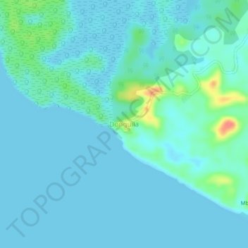
Name: Donguila topographic map, elevation, terrain.
Location: Donguila, Estuaire Province, Gabon (0.18013 9.71222 0.22013 9.75222)
Average elevation: 8 m
Minimum elevation: 0 m
Maximum elevation: 60 m
Other topographic maps
Click on a map to view its topography, its elevation and its terrain.
Komo-Mondah Department
Komo-Mondah Department, Estuaire Province, Gabon
Average elevation: 23 m