
Woodhill topographic map
Interactive map
Click on the map to display elevation.
About this map
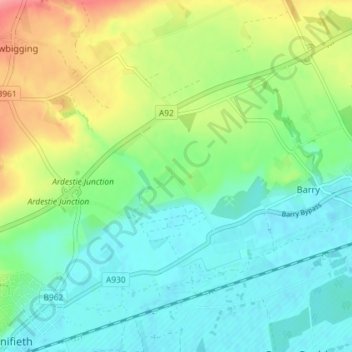
Name: Woodhill topographic map, elevation, terrain.
Location: Woodhill, Monifieth, Angus, Scotland, DD7 7SB, United Kingdom (56.48060 -2.80340 56.52060 -2.76340)
Average elevation: 31 m
Minimum elevation: 4 m
Maximum elevation: 89 m
Other topographic maps
Click on a map to view its topography, its elevation and its terrain.
Ashludie Farm
United Kingdom > Scotland > Angus > Monifieth
Ashludie Farm, Monifieth, Angus, Scotland, DD5 4JE, United Kingdom
Average elevation: 29 m
Mains of Ardestie
United Kingdom > Scotland > Angus > Monifieth
Mains of Ardestie, Monifieth, Angus, Scotland, DD5 4HX, United Kingdom
Average elevation: 40 m