
Serunai topographic map
Interactive map
Click on the map to display elevation.
About this map
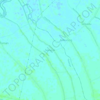
Name: Serunai topographic map, elevation, terrain.
Location: Serunai, Salatiga, Sambas, West Kalimantan, Indonesia (1.10606 109.03960 1.14606 109.07960)
Average elevation: 2 m
Minimum elevation: 0 m
Maximum elevation: 6 m
Other topographic maps
Click on a map to view its topography, its elevation and its terrain.
Sejangkung
Indonesia > West Kalimantan > Sambas
Sejangkung is a district in Sambas Regency, West Kalimantan, Indonesia. It is located on the western side of the island of Borneo, bordering Galing and Sajingan Besar to the north, Jagoi Babang and Seluas to the east, Subah and Sajad to the south, as well as Sambas and Teluk Keramat to the west. The district…
Average elevation: 17 m