
River Roden topographic map
Interactive map
Click on the map to display elevation.
About this map
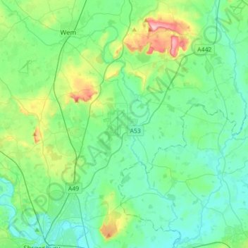
Name: River Roden topographic map, elevation, terrain.
Average elevation: 80 m
Minimum elevation: 45 m
Maximum elevation: 209 m
Other topographic maps
Click on a map to view its topography, its elevation and its terrain.
High Hatton
United Kingdom > England > Shropshire > Stanton upon Hine Heath
High Hatton, Stanton upon Hine Heath, Shropshire, England, SY4 4EZ, United Kingdom
Average elevation: 75 m