
Chinnar topographic map
Interactive map
Click on the map to display elevation.
About this map
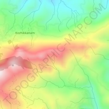
Name: Chinnar topographic map, elevation, terrain.
Location: Chinnar, Peerumade, Idukki, Kerala, India (9.61446 76.98500 9.64014 77.01536)
Average elevation: 1,140 m
Minimum elevation: 844 m
Maximum elevation: 1,500 m
Other topographic maps
Click on a map to view its topography, its elevation and its terrain.
chithirapuram
chithirapuram, Devikulam, Idukki, Kerala, India
Average elevation: 940 m
Pond at Kesavan Purayidom, Kanjikuzhy
Pond at Kesavan Purayidom, Kanjikuzhy, Idukki, Kerala, India
Average elevation: 639 m
Western Ghats
Western Ghats, Idukki, Kerala, 685614, India
Average elevation: 2,225 m
Meesapulimala
Meesapulimala, Idukki, Kerala, 685618, India
Average elevation: 2,221 m