
Thank you for supporting this site ❤️
Make a donation
Make a donation
Gear up for your next adventure:
As an Amazon Associate, this site earns from qualifying purchases at no extra cost to you.
Langhe topographic map
Click on the map to display elevation.
Thank you for supporting this site ❤️
Make a donation
Make a donation
Gear up for your next adventure:
As an Amazon Associate, this site earns from qualifying purchases at no extra cost to you.
About this map
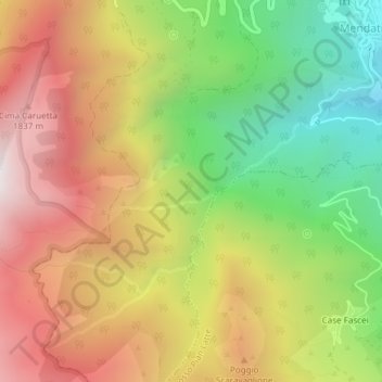
Name: Langhe topographic map, elevation, terrain.
Location: Langhe, Mendatica, Imperia, Liguria, 18025, Italy (44.05483 7.77826 44.07483 7.79826)
Average elevation: 1,330 m
Minimum elevation: 686 m
Maximum elevation: 1,972 m
Thank you for supporting this site ❤️
Make a donation
Make a donation
Gear up for your next adventure:
As an Amazon Associate, this site earns from qualifying purchases at no extra cost to you.