
Nsujjumpolwe topographic map
Interactive map
Click on the map to display elevation.
About this map
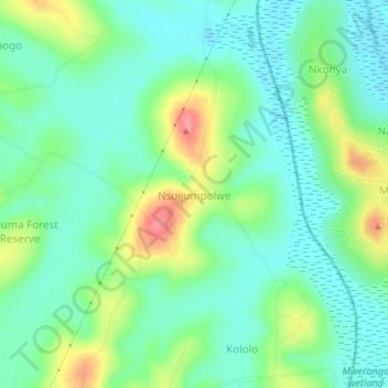
Name: Nsujjumpolwe topographic map, elevation, terrain.
Location: Nsujjumpolwe, Mpigi, Central Region, Uganda (0.28119 32.38947 0.32119 32.42947)
Average elevation: 1,168 m
Minimum elevation: 1,141 m
Maximum elevation: 1,228 m
Other topographic maps
Click on a map to view its topography, its elevation and its terrain.