Geolocate

Khao Lat Mai Kaeo topographic map

Click on the map to display elevation.

About this map

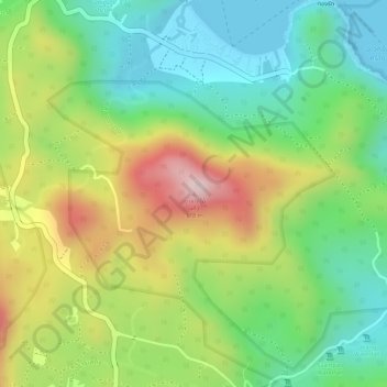
Name: Khao Lat Mai Kaeo topographic map, elevation, terrain.

Location: Khao Lat Mai Kaeo, Ban Tai, Surat Thani Province, Thailand (9.75942 100.05664 9.75952 100.05674)

Average elevation: 142 m

Minimum elevation: 0 m

Maximum elevation: 342 m

Other topographic maps

Click on a map to view its topography, its elevation and its terrain.

Ko Samui

Thailand > Surat Thani Province

Ko Samui, Surat Thani Province, Thailand

Average elevation: 75 m

Ko Pha Ngan

Thailand > Surat Thani Province

Ko Pha Ngan, Surat Thani Province, Thailand

Average elevation: 84 m

Baan Tha Po

Thailand > Surat Thani Province

Baan Tha Po, Surat Thani Province, 84310, Thailand

Average elevation: 50 m

Ban Na Doem

Thailand > Surat Thani Province

Ban Na Doem, Surat Thani Province, Thailand

Average elevation: 27 m

Ko Pha-ngan

Thailand > Surat Thani Province

Ko Pha-ngan, Phet Pha-ngan, Surat Thani Province, 84280, Thailand

Average elevation: 30 m

Haad Khuat

Thailand > Surat Thani Province

Haad Khuat, Phet Pha-ngan, Surat Thani Province, Thailand

Average elevation: 116 m

Ko Tao

Thailand > Surat Thani Province

Ko Tao, Surat Thani Province, Thailand

Average elevation: 35 m

Baan Bang Rak

Thailand > Surat Thani Province

Baan Bang Rak, Surat Thani Province, 84320, Thailand

Average elevation: 21 m

Moo 1

Thailand > Surat Thani Province

Moo 1, Surat Thani Province, 84-280, Thailand

Average elevation: 21 m

Haad Salad

Thailand > Surat Thani Province

Haad Salad, Surat Thani Province, 84820, Thailand

Average elevation: 59 m

In order to remain free and to keep improving, this site uses cookies created by Google to compile visit statistics and display personalized advertisements.

How is the collected data used?