
Cher topographic map
Interactive map
Click on the map to display elevation.
About this map
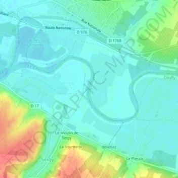
Name: Cher topographic map, elevation, terrain.
Average elevation: 80 m
Minimum elevation: 65 m
Maximum elevation: 121 m
Other topographic maps
Click on a map to view its topography, its elevation and its terrain.
Les Ponts
France > Centre-Val de Loire > Loir-et-Cher > Noyers-sur-Cher > Les Ponts
Les Ponts, Noyers-sur-Cher, Romorantin-Lanthenay, Loir-et-Cher, Centre-Val de Loire, France métropolitaine, 41140, France
Average elevation: 88 m