
Ciechanów topographic map
Interactive map
Click on the map to display elevation.
About this map
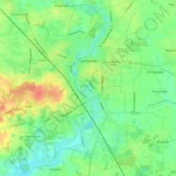
Name: Ciechanów topographic map, elevation, terrain.
Location: Ciechanów, Ciechanów County, Masovian Voivodeship, Poland (52.83612 20.56067 52.90606 20.66914)
Average elevation: 122 m
Minimum elevation: 103 m
Maximum elevation: 151 m