Siberia topographic map
Click on the map to display elevation.
Siberia
Eastern and central Sakha comprises numerous north–south mountain ranges of various ages. These mountains extend up to almost 3,000 metres (9,800 ft), but above a few hundred metres they are almost completely devoid of vegetation. The Verkhoyansk Range was extensively glaciated in the Pleistocene, but the climate was too dry for glaciation to extend to low elevations. At these low elevations are numerous valleys, many of them deep and covered with larch forest, except in the extreme north where the tundra dominates. Soils are mainly turbels (a type of gelisol). The active layer tends to be less than one metre deep, except near rivers.
About this map
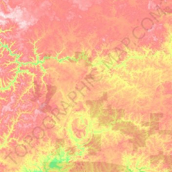
Name: Siberia topographic map, elevation, terrain.
Average elevation: 346 m
Minimum elevation: 162 m
Maximum elevation: 663 m
Other topographic maps
Click on a map to view its topography, its elevation and its terrain.