
Nommern topographic map
Interactive map
Click on the map to display elevation.
About this map
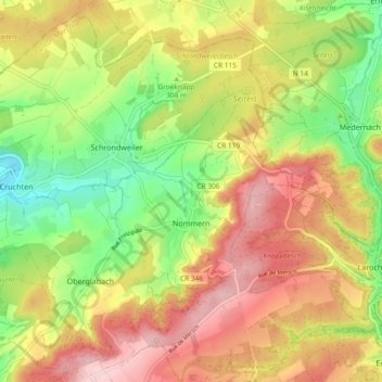
Name: Nommern topographic map, elevation, terrain.
Location: Nommern, Canton Mersch, Luxembourg (49.77108 6.10458 49.82674 6.19733)
Average elevation: 320 m
Minimum elevation: 208 m
Maximum elevation: 431 m
Other topographic maps
Click on a map to view its topography, its elevation and its terrain.