
Make a donation
Gear up for your next adventure:
As an Amazon Associate, this site earns from qualifying purchases at no extra cost to you.
Cypress Mill topographic map
Click on the map to display elevation.
Make a donation
Gear up for your next adventure:
As an Amazon Associate, this site earns from qualifying purchases at no extra cost to you.
About this map
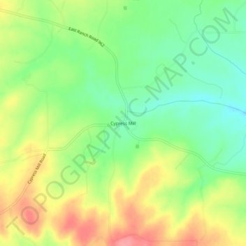
Name: Cypress Mill topographic map, elevation, terrain.
Location: Cypress Mill, Blanco County, Texas, 78663, United States (30.36103 -98.27057 30.40103 -98.23057)
Average elevation: 318 m
Minimum elevation: 280 m
Maximum elevation: 365 m
Make a donation
Gear up for your next adventure:
As an Amazon Associate, this site earns from qualifying purchases at no extra cost to you.
Other topographic maps
Click on a map to view its topography, its elevation and its terrain.
Pedernales Falls State Park
United States > Texas > Blanco County > Johnson City
Average elevation: 303 m
Make a donation
Gear up for your next adventure:
As an Amazon Associate, this site earns from qualifying purchases at no extra cost to you.