
Fresno topographic map
Interactive map
Click on the map to display elevation.
About this map
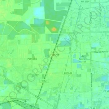
Name: Fresno topographic map, elevation, terrain.
Average elevation: 21 m
Minimum elevation: 12 m
Maximum elevation: 35 m
Other topographic maps
Click on a map to view its topography, its elevation and its terrain.
Rosenberg
États-Unis d'Amérique > Texas > Fort Bend County
Rosenberg, Fort Bend County, Texas, 77471, États-Unis d'Amérique
Average elevation: 28 m