
Klipfontein Dam topographic map
Interactive map
Click on the map to display elevation.
About this map
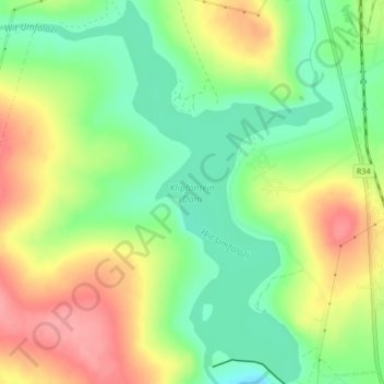
Name: Klipfontein Dam topographic map, elevation, terrain.
Average elevation: 1,117 m
Minimum elevation: 1,073 m
Maximum elevation: 1,169 m
Other topographic maps
Click on a map to view its topography, its elevation and its terrain.
Ngome Forest
RSA > KwaZulu-Natal > Abaqulusi Local Municipality
Ngome Forest, Abaqulusi Local Municipality, Zululand District Municipality, KwaZulu-Natal, RSA
Average elevation: 1,095 m