
Drielaker-Moor topographic map
Interactive map
Click on the map to display elevation.
About this map
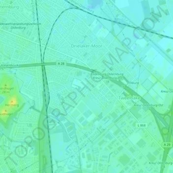
Name: Drielaker-Moor topographic map, elevation, terrain.
Location: Drielaker-Moor, Oldenburg, Lower Saxony, 26135, Germany (53.10608 8.23847 53.13431 8.27050)
Average elevation: 5 m
Minimum elevation: 0 m
Maximum elevation: 18 m
Other topographic maps
Click on a map to view its topography, its elevation and its terrain.