
Veurne topographic map
Interactive map
Click on the map to display elevation.
About this map
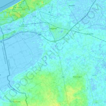
Name: Veurne topographic map, elevation, terrain.
Location: Veurne, Westflandern, Flandern, 8630, Belgien (50.98545 2.56585 51.09769 2.77691)
Average elevation: 3 m
Minimum elevation: -5 m
Maximum elevation: 18 m