
Cuchillas topographic map
Interactive map
Click on the map to display elevation.
About this map
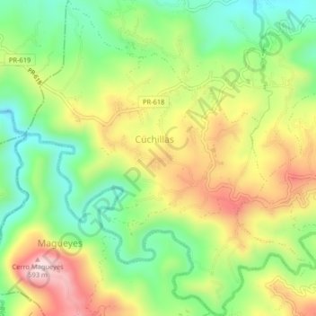
Name: Cuchillas topographic map, elevation, terrain.
Location: Cuchillas, Corozal, Puerto Rico, United States (18.27167 -66.37782 18.31008 -66.34121)
Average elevation: 384 m
Minimum elevation: 206 m
Maximum elevation: 615 m
Other topographic maps
Click on a map to view its topography, its elevation and its terrain.
Corozal
United States > Puerto Rico > Corozal > Corozal
Corozal, Puerto Rico, 00687, United States
Average elevation: 173 m