
Solon topographic map
Click on the map to display elevation.
About this map
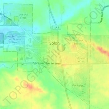
Name: Solon topographic map, elevation, terrain.
Location: Solon, Johnson County, Iowa, United States (41.79176 -91.52079 41.81742 -91.47987)
Average elevation: 238 m
Minimum elevation: 219 m
Maximum elevation: 261 m
Other topographic maps
Click on a map to view its topography, its elevation and its terrain.
Iowa City
United States > Iowa > Johnson County > Iowa City
The elevation at the Iowa City Municipal Airport is 668 ft (203.6 m) above sea level.
Average elevation: 225 m