Geolocate

Roydon topographic map

Click on the map to display elevation.

About this map

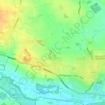
Name: Roydon topographic map, elevation, terrain.

Location: Roydon, South Norfolk, Norfolk, England, United Kingdom (52.37180 1.05901 52.39856 1.10607)

Average elevation: 37 m

Minimum elevation: 22 m

Maximum elevation: 54 m

Norfolk trails, hiking, mountain biking, running and outdoor activities

Gear up for your next adventure:

👖Convertible Hiking Trousers - Versatile zip-off pants for changing mountain weather conditions
🧢Hiking Hats - Sun and weather protection for outdoor walks
🛌Sleeping Mats - Insulated mats for comfortable outdoor sleeping
🛌Insulated Sleeping Mats - Crucial thermal protection when sleeping on cold, uneven ground
🧥Packable Down Jackets - Lightweight warmth that compresses small in your bag

As an Amazon Associate, this site earns from qualifying purchases at no extra cost to you.