
Valley View topographic map
Interactive map
Click on the map to display elevation.
About this map
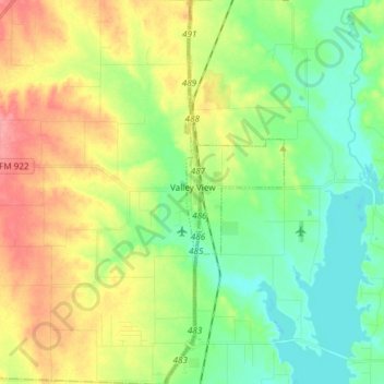
Name: Valley View topographic map, elevation, terrain.
Location: Valley View, Cooke County, Texas, United States (33.42391 -97.17610 33.54900 -97.12934)
Average elevation: 222 m
Minimum elevation: 190 m
Maximum elevation: 272 m
Other topographic maps
Click on a map to view its topography, its elevation and its terrain.
Gainesville
United States > Texas > Cooke County
Gainesville, Cooke County, Texas, 76240, United States
Average elevation: 248 m
Ray Roberts Lake
United States > Texas > Cooke County > Tioga
Ray Roberts Lake, Tioga, Cooke County, Texas, 76272, United States
Average elevation: 203 m
Muenster
United States > Texas > Cooke County
Muenster, Cooke County, Texas, 76252, United States
Average elevation: 315 m