
Guerrouaou topographic map
Interactive map
Click on the map to display elevation.
About this map
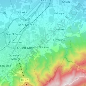
Name: Guerrouaou topographic map, elevation, terrain.
Location: Guerrouaou, Boufarik District, Blida, 09480, Algeria (36.45263 2.86710 36.55189 2.90285)
Average elevation: 368 m
Minimum elevation: 68 m
Maximum elevation: 1,490 m