
飯山市 topographic map
Interactive map
Click on the map to display elevation.
About this map
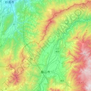
Name: 飯山市 topographic map, elevation, terrain.
Location: 飯山市, 長野県, 日本 (36.80354 138.27425 37.02969 138.51984)
Average elevation: 633 m
Minimum elevation: 53 m
Maximum elevation: 1,720 m
Other topographic maps
Click on a map to view its topography, its elevation and its terrain.