Geolocate

Casoni topographic map

Click on the map to display elevation.

About this map

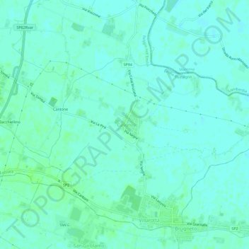
Name: Casoni topographic map, elevation, terrain.

Location: Casoni, Luzzara, Bassa Reggiana, Reggio nell'Emilia, Emilia-Romagna, 42045, Italy (44.91918 10.71732 44.95918 10.75732)

Average elevation: 19 m

Minimum elevation: 16 m

Maximum elevation: 23 m

Other topographic maps

Click on a map to view its topography, its elevation and its terrain.

Novellara

Italy > Emilia-Romagna > Reggio nell'Emilia

Average elevation: 23 m

Canossa

Italy > Emilia-Romagna > Reggio nell'Emilia

Average elevation: 408 m

Viano

Italy > Emilia-Romagna > Reggio nell'Emilia

Average elevation: 330 m

Cavriago

Italy > Emilia-Romagna > Reggio nell'Emilia

Average elevation: 74 m

Gear up for your next adventure:

💧Hydration Reservoirs - Convenient water bladders for hands-free drinking on the move
🍲Portable Camping Stoves - Fast-boiling stoves for hot meals on remote topographic survey trips
📱Phone Mounts for Hiking - Secure mounts to carry your phone on trails
🧢Thermal Beanie Hats - Prevent heat loss from the head in windy summit conditions
📷Outdoor Action Cameras - Cameras designed for hiking and adventure

As an Amazon Associate, this site earns from qualifying purchases at no extra cost to you.