
Haute-Sorne topographic map
Interactive map
Click on the map to display elevation.
About this map
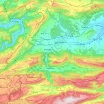
Name: Haute-Sorne topographic map, elevation, terrain.
Location: Haute-Sorne, District de Delémont, Jura, 2863, Suiza (47.28416 7.13733 47.36507 7.33751)
Average elevation: 763 m
Minimum elevation: 425 m
Maximum elevation: 1,330 m