
Lac Ste. Anne topographic map
Interactive map
Click on the map to display elevation.
About this map
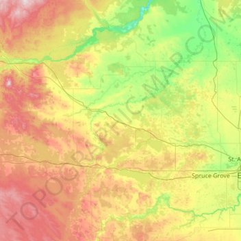
Name: Lac Ste. Anne topographic map, elevation, terrain.
Location: Lac Ste. Anne, Alberta, Kanada (53.19146 -115.35649 54.47146 -114.07649)
Average elevation: 754 m
Minimum elevation: 578 m
Maximum elevation: 1,187 m
Other topographic maps
Click on a map to view its topography, its elevation and its terrain.
Municipal District of Willow Creek
Municipal District of Willow Creek, Alberta, Kanada
Average elevation: 1,231 m
Crowfoot Glacier
Crowfoot Glacier, Crowfoot Mountain Approach Route, Alberta, Kanada
Average elevation: 2,550 m
Peyto Glacier
Peyto Glacier, Trapper Peak Route, Columbia-Shuswap Regional District, Alberta, Kanada
Average elevation: 2,421 m
Lesser Slave River
Lesser Slave River, Township Road 730B, Municipal District of Lesser Slave River, Alberta, Kanada
Average elevation: 592 m