
Make a donation
Gear up for your next adventure:
As an Amazon Associate, this site earns from qualifying purchases at no extra cost to you.
Palm Springs topographic map
Click on the map to display elevation.
Make a donation
Gear up for your next adventure:
As an Amazon Associate, this site earns from qualifying purchases at no extra cost to you.
Palm Springs
The original village townsite includes a chain of artificial north-to-south oriented lakes linked to canals, engineered in 1957 as a mechanism to promote drainage. Geologically, Palm Springs is located within the Anastasia Formation region, which dominates far eastern Palm Beach County. This type of geological formation is composed primarily of coquina, sand, and sandy limestone. The average elevation of Palm Springs is 10 ft (3.0 m).
Make a donation
Gear up for your next adventure:
As an Amazon Associate, this site earns from qualifying purchases at no extra cost to you.
About this map
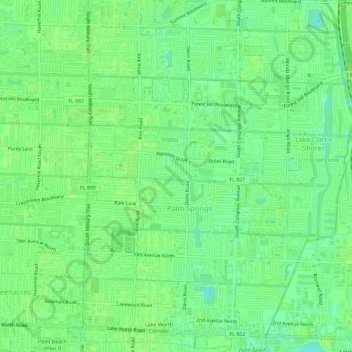
Name: Palm Springs topographic map, elevation, terrain.
Location: Palm Springs, Palm Beach County, Florida, United States (26.61482 -80.11249 26.66627 -80.08007)
Average elevation: 9 m
Minimum elevation: 1 m
Maximum elevation: 11 m
Make a donation
Gear up for your next adventure:
As an Amazon Associate, this site earns from qualifying purchases at no extra cost to you.