
Hyde Park topographic map
Interactive map
Click on the map to display elevation.
About this map
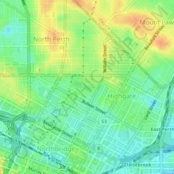
Name: Hyde Park topographic map, elevation, terrain.
Location: Hyde Park, Highgate, Perth, Western Australia, Australia (-31.94006 115.85935 -31.93657 115.86621)
Average elevation: 25 m
Minimum elevation: 8 m
Maximum elevation: 46 m
Other topographic maps
Click on a map to view its topography, its elevation and its terrain.