
Hollingbourne topographic map
Interactive map
Click on the map to display elevation.
About this map
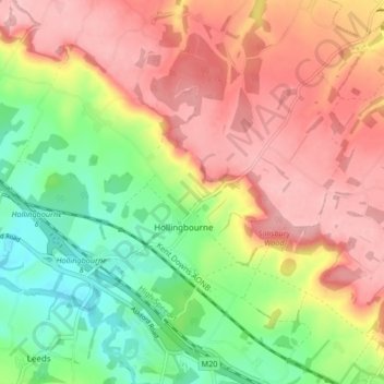
Name: Hollingbourne topographic map, elevation, terrain.
Location: Hollingbourne, Maidstone, Kent, England, United Kingdom (51.24902 0.59798 51.29168 0.68119)
Average elevation: 125 m
Minimum elevation: 41 m
Maximum elevation: 202 m
Kent trails, hiking, mountain biking, running and outdoor activities
Other topographic maps
Click on a map to view its topography, its elevation and its terrain.