
Tegeha topographic map
Interactive map
Click on the map to display elevation.
About this map
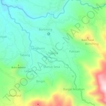
Name: Tegeha topographic map, elevation, terrain.
Location: Tegeha, Bali, Indonésia (-8.17292 115.18173 -8.13292 115.22173)
Average elevation: 369 m
Minimum elevation: 163 m
Maximum elevation: 854 m