
Oedeme topographic map
Interactive map
Click on the map to display elevation.
About this map
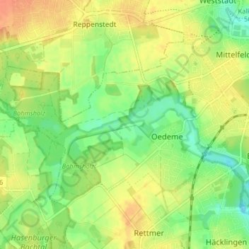
Name: Oedeme topographic map, elevation, terrain.
Location: Oedeme, Lüneburg, Niedersachsen, Deutschland (53.21744 10.33083 53.24349 10.39588)
Average elevation: 35 m
Minimum elevation: 15 m
Maximum elevation: 53 m
Other topographic maps
Click on a map to view its topography, its elevation and its terrain.
Ebensberg
Deutschland > Niedersachsen > Lüneburg > Lüneburg
Ebensberg, Lüneburg, Niedersachsen, Deutschland
Average elevation: 31 m
Weststadt
Deutschland > Niedersachsen > Lüneburg > Lüneburg
Weststadt, Lüneburg, Niedersachsen, Deutschland
Average elevation: 37 m