
Castellar de la Frontera topographic map
Interactive map
Click on the map to display elevation.
About this map
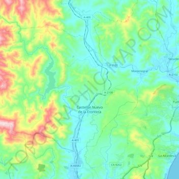
Name: Castellar de la Frontera topographic map, elevation, terrain.
Average elevation: 128 m
Minimum elevation: 0 m
Maximum elevation: 518 m
Other topographic maps
Click on a map to view its topography, its elevation and its terrain.
San Roque
Spanje > Andalusië > Campo de Gibraltar
San Roque, Campo de Gibraltar, Cádiz, Andalusië, Spanje
Average elevation: 71 m