Geolocate

Palodeia topographic map

Click on the map to display elevation.

About this map

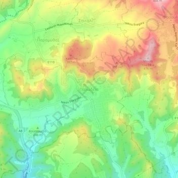
Name: Palodeia topographic map, elevation, terrain.

Location: Palodeia, Limassol District, Cyprus, 4549, Cyprus (34.72845 32.98472 34.76845 33.02472)

Average elevation: 280 m

Minimum elevation: 144 m

Maximum elevation: 459 m

Gear up for your next adventure:

🧣Neck Gaiters - Versatile protection against wind and cold
👟Heavy Duty Boot Laces - Always carry a spare for your hiking footwear
🥾Hiking Boot Waterproofing Wax - Maintain the lifespan of your leather trekking boots
🍲Portable Camping Stoves - Fast-boiling stoves for hot meals on remote topographic survey trips
👖Hiking Trousers - Durable trousers designed for rough terrain

As an Amazon Associate, this site earns from qualifying purchases at no extra cost to you.