
Sebeta topographic map
Interactive map
Click on the map to display elevation.
Sebeta
Sebeta is a town located in the Oromia Special Zone Surrounding Finfinne of the Oromia Region. This town has a latitude and longitude of 8°54′40″N 38°37′17″E / 8.91111°N 38.62139°E / 8.91111; 38.62139 and an elevation of 2,356 meters (7,730 feet) above sea level.
About this map
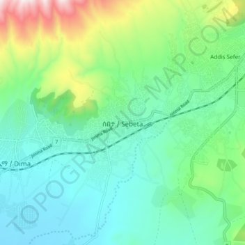
Name: Sebeta topographic map, elevation, terrain.
Location: Sebeta, Oromia Region, Ethiopia (8.87225 38.58402 8.95225 38.66402)
Average elevation: 2,302 m
Minimum elevation: 2,069 m
Maximum elevation: 2,995 m