
Bradworthy topographic map
Interactive map
Click on the map to display elevation.
About this map
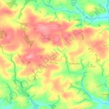
Name: Bradworthy topographic map, elevation, terrain.
Location: Bradworthy, Torridge District, Devon, England, United Kingdom (50.87140 -4.46354 50.94254 -4.35293)
Average elevation: 178 m
Minimum elevation: 124 m
Maximum elevation: 224 m
Devon trails, hiking, mountain biking, running and outdoor activities
Other topographic maps
Click on a map to view its topography, its elevation and its terrain.
Bucks Cross
United Kingdom > England > Devon > Torridge District > Bucks Mills
Average elevation: 123 m