
Oberholz topographic map
Interactive map
Click on the map to display elevation.
About this map
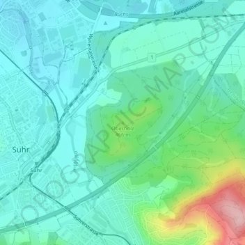
Name: Oberholz topographic map, elevation, terrain.
Location: Oberholz, Suhr, Bezirk Aarau, Aargau, 5034, Schweiz (47.37607 8.09608 47.37617 8.09618)
Average elevation: 419 m
Minimum elevation: 380 m
Maximum elevation: 562 m