
Purmamarca topographic map
Interactive map
Click on the map to display elevation.
Purmamarca
Purmamarca ist ein Dorf im Departamento Tumbaya in der Provinz Jujuy im Nordwesten Argentiniens. Es liegt auf einer Höhe von 2206 Metern und gilt als Tor zur Schlucht Quebrada de Humahuaca. Das kleine, indianisch geprägte Dorf zählt 2095 Einwohner im Jahr 2001. Am nördlichen Ortsrand fließt der Río Purmamarca vorbei, und im Süden befinden sich farbige Bergformationen, für die Purmamarca bekannt ist.
About this map
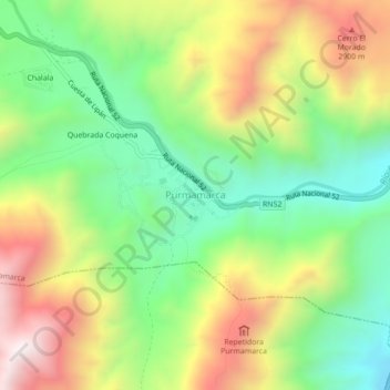
Name: Purmamarca topographic map, elevation, terrain.
Average elevation: 2,566 m
Minimum elevation: 2,172 m
Maximum elevation: 3,110 m