
Thank you for supporting this site ❤️
Make a donation
Make a donation
Gear up for your next adventure:
As an Amazon Associate, this site earns from qualifying purchases at no extra cost to you.
Naramata Dam topographic map
Click on the map to display elevation.
Thank you for supporting this site ❤️
Make a donation
Make a donation
Gear up for your next adventure:
As an Amazon Associate, this site earns from qualifying purchases at no extra cost to you.
About this map
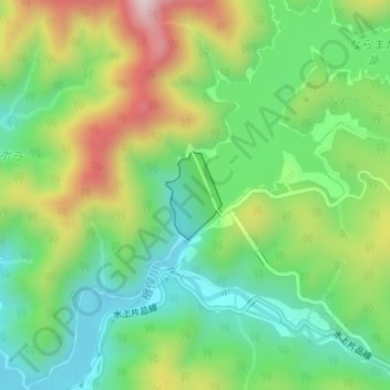
Name: Naramata Dam topographic map, elevation, terrain.
Location: Naramata Dam, Minakami, Tone County, Gunma Prefecture, Japan (36.87852 139.07611 36.88454 139.08083)
Average elevation: 913 m
Minimum elevation: 735 m
Maximum elevation: 1,214 m
Thank you for supporting this site ❤️
Make a donation
Make a donation
Gear up for your next adventure:
As an Amazon Associate, this site earns from qualifying purchases at no extra cost to you.