
Kerstenhausen topographic map
Interactive map
Click on the map to display elevation.
About this map
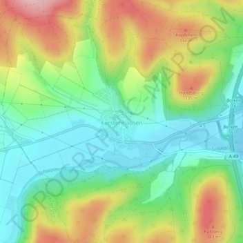
Name: Kerstenhausen topographic map, elevation, terrain.
Location: Kerstenhausen, Borken, Schwalm-Eder-Kreis, Hessen, Deutschland (51.05198 9.19347 51.08070 9.23538)
Average elevation: 255 m
Minimum elevation: 180 m
Maximum elevation: 371 m