
Thank you for supporting this site ❤️
Make a donation
Make a donation
Gear up for your next adventure:
As an Amazon Associate, this site earns from qualifying purchases at no extra cost to you.
Mechuka topographic map
Click on the map to display elevation.
Thank you for supporting this site ❤️
Make a donation
Make a donation
Gear up for your next adventure:
As an Amazon Associate, this site earns from qualifying purchases at no extra cost to you.
About this map
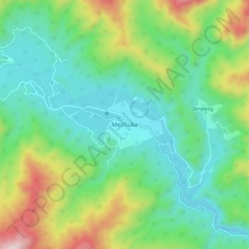
Name: Mechuka topographic map, elevation, terrain.
Location: Mechuka, Mechuka ADC, Shi Yomi, Arunachal Pradesh, India (28.55875 94.09358 28.63875 94.17358)
Average elevation: 2,165 m
Minimum elevation: 1,886 m
Maximum elevation: 2,862 m
Thank you for supporting this site ❤️
Make a donation
Make a donation
Gear up for your next adventure:
As an Amazon Associate, this site earns from qualifying purchases at no extra cost to you.