Geolocate

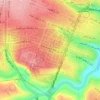
Abdoun topographic map

Click on the map to display elevation.

About this map

Name: Abdoun topographic map, elevation, terrain.

Location: Abdoun, منطقة زهران, Amman, Amman Sub-District, Amman Qasabah District, Amman, 11181, Jordan (31.93883 35.88266 31.95883 35.90266)

Average elevation: 895 m

Minimum elevation: 780 m

Maximum elevation: 983 m

Other topographic maps

Click on a map to view its topography, its elevation and its terrain.
Housing Bank Garden

Jordan > Amman > Amman Sub-District > Amman

Average elevation: 898 m

Gear up for your next adventure:

⌚GPS Outdoor Watches - Watches with GPS tracking for hiking and exploration
🔋Solar Chargers - Eco-friendly charging solutions for outdoor use
🔥Emergency Fire Starters - Reliable ignition tools for survival situations in damp conditions
🚲Bikepacking Frame Bags - Storage for tools and navigation gear on long off-road rides
🧺Ultralight Dry Bags - Organize and waterproof your gear inside your rucksack

As an Amazon Associate, this site earns from qualifying purchases at no extra cost to you.