
Thank you for supporting this site ❤️
Make a donation
Make a donation
Gear up for your next adventure:
As an Amazon Associate, this site earns from qualifying purchases at no extra cost to you.
Chaguarpamba topographic map
Click on the map to display elevation.
Thank you for supporting this site ❤️
Make a donation
Make a donation
Gear up for your next adventure:
As an Amazon Associate, this site earns from qualifying purchases at no extra cost to you.
About this map
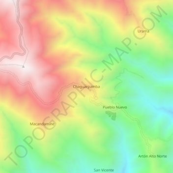
Name: Chaguarpamba topographic map, elevation, terrain.
Location: Chaguarpamba, Parroquia Utuana, Cantón Calvas, Loja, Ecuador (-4.38651 -79.70626 -4.34651 -79.66626)
Average elevation: 2,007 m
Minimum elevation: 1,459 m
Maximum elevation: 2,597 m
Thank you for supporting this site ❤️
Make a donation
Make a donation
Gear up for your next adventure:
As an Amazon Associate, this site earns from qualifying purchases at no extra cost to you.