
Ritchie County topographic map
Interactive map
Click on the map to display elevation.
About this map
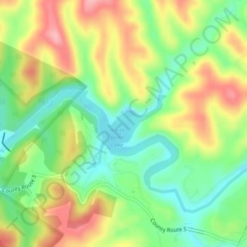
Name: Ritchie County topographic map, elevation, terrain.
Location: Ritchie County, Virginie-Occidentale, États-Unis d'Amérique (39.22156 -81.08285 39.22260 -81.08164)
Average elevation: 266 m
Minimum elevation: 209 m
Maximum elevation: 338 m
Other topographic maps
Click on a map to view its topography, its elevation and its terrain.
Graux
États-Unis d'Amérique > Virginie-Occidentale > Roane County
Graux, Roane County, Virginie-Occidentale, États-Unis d'Amérique
Average elevation: 306 m
May
États-Unis d'Amérique > Virginie-Occidentale > May
May, Pocahontas County, Virginie-Occidentale, États-Unis d'Amérique
Average elevation: 1,009 m