
Bordj Sabat topographic map
Interactive map
Click on the map to display elevation.
About this map
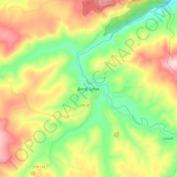
Name: Bordj Sabat topographic map, elevation, terrain.
Location: Bordj Sabat, Oued Zenati District, Guelma, Algeria (36.36184 7.00560 36.44184 7.08560)
Average elevation: 665 m
Minimum elevation: 445 m
Maximum elevation: 933 m