Geolocate

Augustenborg topographic map

Click on the map to display elevation.

About this map

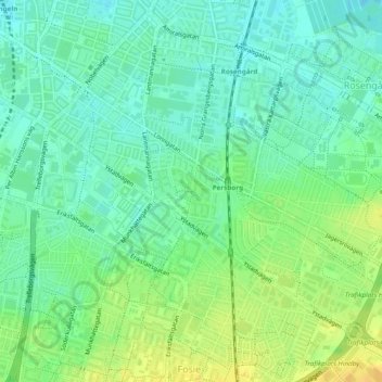
Name: Augustenborg topographic map, elevation, terrain.

Location: Augustenborg, Söder, Malmo, Malmö kommun, Skåne County, Sweden (55.57529 13.01893 55.58417 13.02976)

Average elevation: 18 m

Minimum elevation: 7 m

Maximum elevation: 32 m

Other topographic maps

Click on a map to view its topography, its elevation and its terrain.

Bunkeflo

Sweden > Skåne County > Malmo

Average elevation: 14 m

Arlöv

Sweden > Skåne County > Malmo

Average elevation: 8 m

Helge

Sweden > Skåne County > Malmo

Average elevation: 7 m

Gear up for your next adventure:

🧴Tick Removal Tools - Small, essential health tool for UK woodland and moorland
🧷Tenacious Repair Tape - Instant fix for torn tents, jackets, or dry bags
👖Convertible Hiking Trousers - Versatile zip-off pants for changing mountain weather conditions
👖Hiking Trousers - Durable trousers designed for rough terrain
🥾Walking Shoes - Lightweight walking shoes for countryside and coastal paths

As an Amazon Associate, this site earns from qualifying purchases at no extra cost to you.