Geolocate

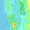
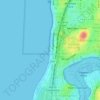
Midland topographic map

Click on the map to display elevation.

About this map

Name: Midland topographic map, elevation, terrain.

Location: Midland, Perth, Western Australia, Australia (-31.90552 115.99613 -31.87794 116.02335)

Average elevation: 12 m

Minimum elevation: 0 m

Maximum elevation: 21 m

Other topographic maps

Click on a map to view its topography, its elevation and its terrain.
Canning river

Australia > Western Australia > Perth

Average elevation: 293 m

Adenia Lagoon

Australia > Western Australia > Perth

Average elevation: 9 m

Lake Claremont

Australia > Western Australia > Perth

Average elevation: 22 m

Reabold Hill

Australia > Western Australia > Perth

Average elevation: 32 m

Mundaring Weir

Australia > Western Australia > Perth

Average elevation: 185 m

Lake Gwelup

Australia > Western Australia > Perth

Average elevation: 25 m

Mosman Beach

Australia > Western Australia > Perth

Average elevation: 9 m

Woodford Park

Australia > Western Australia > Perth

Average elevation: 11 m

Hatfield Park

Australia > Western Australia > Perth

Average elevation: 24 m

Brittania Reserve

Australia > Western Australia > Perth

Average elevation: 25 m

Alderley Park

Australia > Western Australia > Perth

Average elevation: 10 m

Bold Park

Australia > Western Australia > Perth

Average elevation: 34 m

Gear up for your next adventure:

📦Dry Bags - Waterproof bags to protect gear from rain
🎒Backpack Rain Covers - Universal waterproof covers to protect your gear from downpours
🧥Packable Down Jackets - Lightweight warmth that compresses small in your bag
🌂Windproof Trekking Umbrellas - Surprising but effective rain protection on low-wind trails
👟Women's Trail Running Shoes - Agile footwear for fell running and technical trails

As an Amazon Associate, this site earns from qualifying purchases at no extra cost to you.